

On 12 March 2024, the group presented Computing Sciences in Agriculture at a collaborative research meeting in Lacombe, Alberta. The talk was delivered by Alvin (Xinyao) Sun on behalf of the ROSS group led by Professor Irene Cheng. The meeting brought together the University of Alberta, Agriculture and Agri-Food Canada (AAFC) and Livestock Gentec, under the theme of enhancing collaboration between the University of Alberta and AAFC to support the Canadian livestock sector.
The talk followed a single arc, from space down to the barn, showing how one set of sensing and machine-learning methods reaches across very different scales of agriculture.
From space
It opened with Earth observation: remote sensing from satellite, drone and LiDAR, and why this matters to Canada. The group pointed to national policy, citing Canada’s New Space Strategy (2019) and Canada’s Strategy for Satellite Earth Observation (2022) as evidence of a sustained commitment to using space-based data for science, innovation and economic growth.
Because spectral signatures are unique to surface materials, imagery can be read for soil, vegetation and water quality. That capability supports practical tasks the meeting cared about: monitoring pasture health, evaluating plant health, and discriminating invasive plants from healthy forage.
Sharper satellite data
The talk then turned to satellite data enhancement, the same hyperspectral reconstruction and 30 m to 10 m sharpening work the group had also shown at Olds AgSmart. Recovering finer spatial detail lets analysts read field boundaries and watercourses that the original coarse imagery blurs.
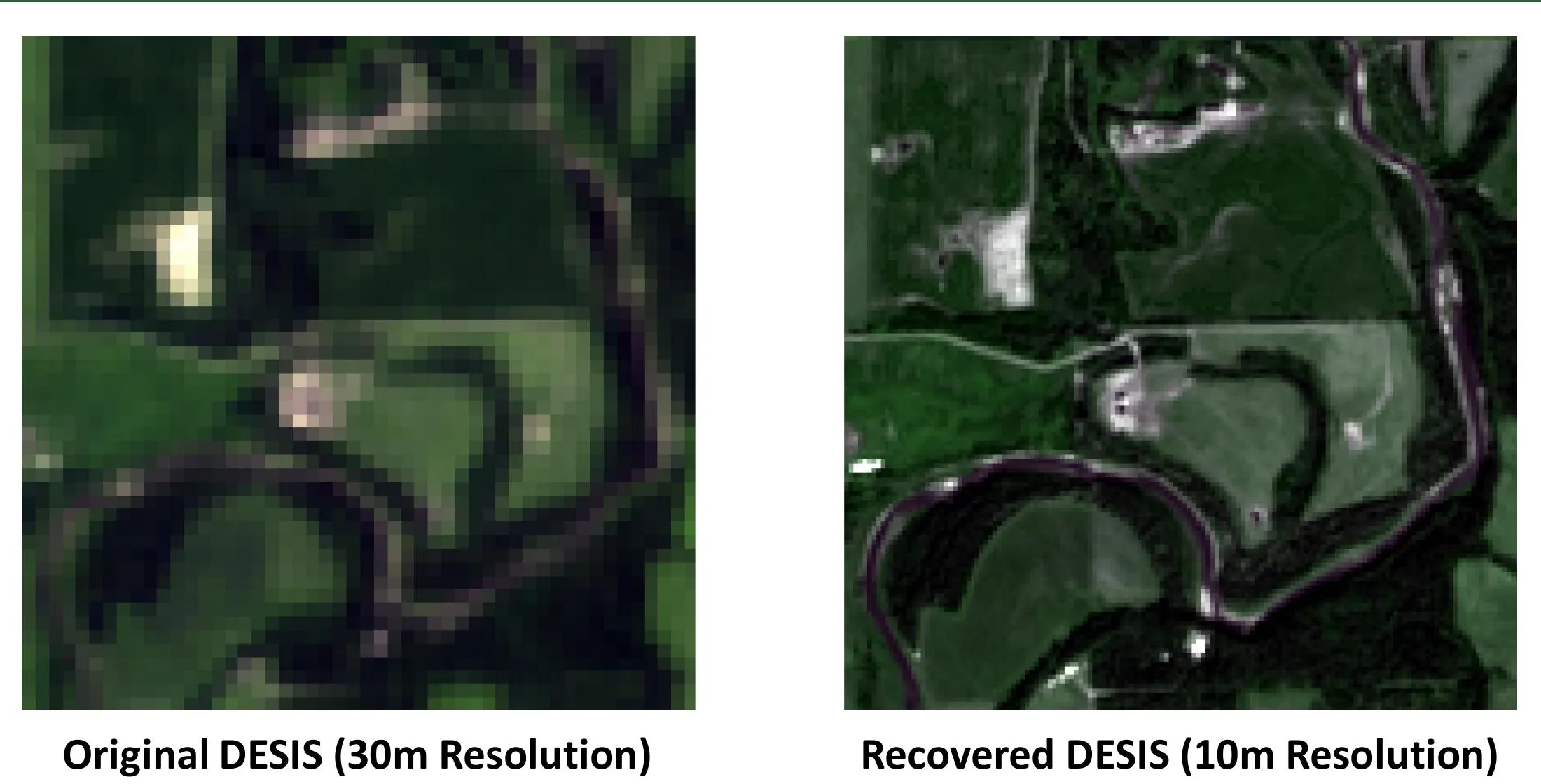 Satellite data enhancement shown at the meeting: original 30 m DESIS imagery (left) and the recovered 10 m result (right). Figure by the ROSS group.
Down to the drone
Descending from satellite to drone, the group described cattle monitoring in the open field using paired thermal and optical sensors. The cover image shows the idea: dark cattle blend into pasture in the optical view, but the same animals stand out clearly in thermal, where their body heat makes them glow against the cooler ground.
That advantage grows in hard conditions. In a snow-covered field, the group showed how a thermal camera on a drone picks out animals and activity that are almost invisible optically, letting a producer locate and count a herd that would otherwise be lost against the snow.
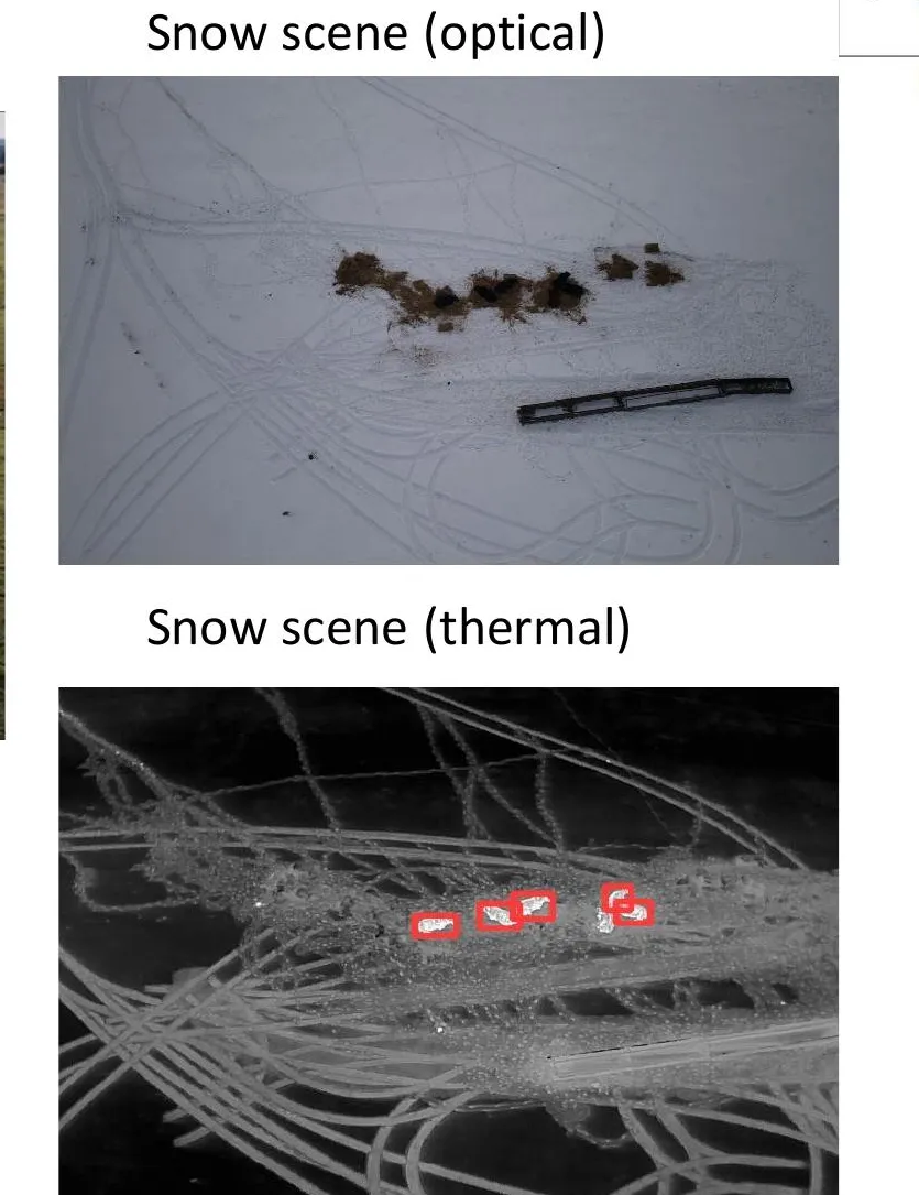 A snow scene in optical (top) and thermal (bottom): the thermal view reveals warm targets, marked in red, that the optical image barely shows. Figure by the ROSS group.
Into the barn
The final step took the work indoors, extending sensing and data analytics to housed livestock. This strand is a collaboration with the Faculty of Agricultural, Life and Environmental Sciences (ALES) at the University of Alberta, with Professor Graham Plastow and Tiago Da Silva Valente.
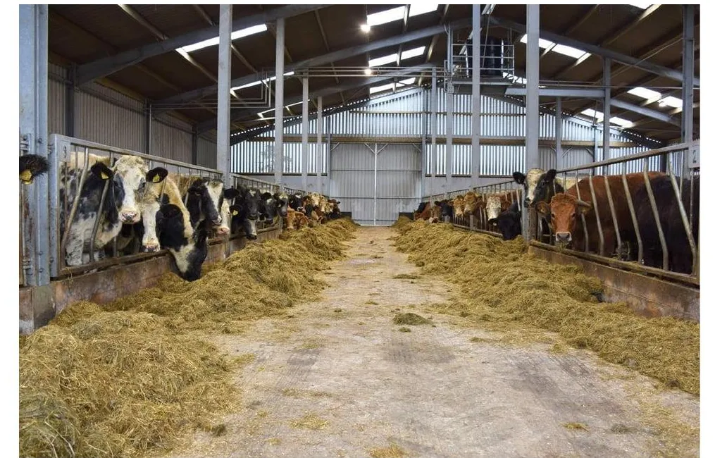 Indoors, the same sensing question moves from a pasture to a feed rail: monitoring housed cattle. Figure by the ROSS group.
Inside, thermal and depth sensing carry over from the field. A thermal view separates a warm animal from its surroundings, while a depth map recovers three-dimensional shape, inputs that feed analytics such as body condition and behaviour.
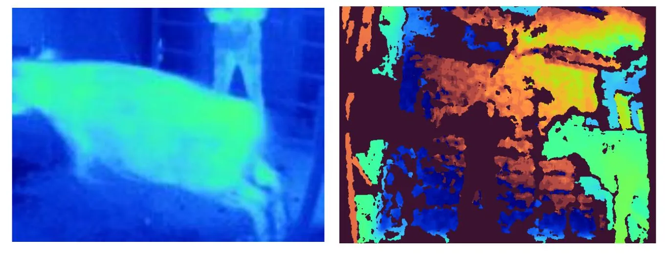 Indoor sensing modalities: a thermal image (left) isolates the warm animal, and a depth map (right) recovers three-dimensional shape. Figure by the ROSS group.
The talk credited the wider team behind this arc: Professor Irene Cheng, with students Fan Yang, Fei Yang, Joshua Billson, MD Samiul Islam, Sachin Vijay Kumar and Karansinh Padhiar. Taken together, the presentation showed the breadth of the group’s agricultural sensing, from satellites in orbit to sensors in the barn.
Further reading: Space Strategy for Canada (2019), Canadian Space Agency, Canada’s Strategy for Satellite Earth Observation (2022), Canadian Space Agency, Lacombe Research and Development Centre, Government of Canada