

Rice is a staple food for over half the world’s population and supplies roughly one fifth of global caloric demand. More than a quarter of the world’s developed freshwater goes to growing it, and methane from rice farming carries 21 times the warming potential of CO₂. Knowing where rice grows, accurately and at scale, matters for food security and the environment alike.
Our method applies vision transformers to multi-temporal Sentinel-1 SAR time series: 3D convolutions with temporal max-pooling feed a transformer encoder-decoder that turns a season of radar observations into a rice map.
The study area spans nine regions across southern and central Brazil, totalling 42,481 km², with the Santa Catarina 2017/2018 season shown in detail. In qualitative comparisons, our approach (SCAN) outperforms LSTM, TFBS, SegFormer and SETR baselines.
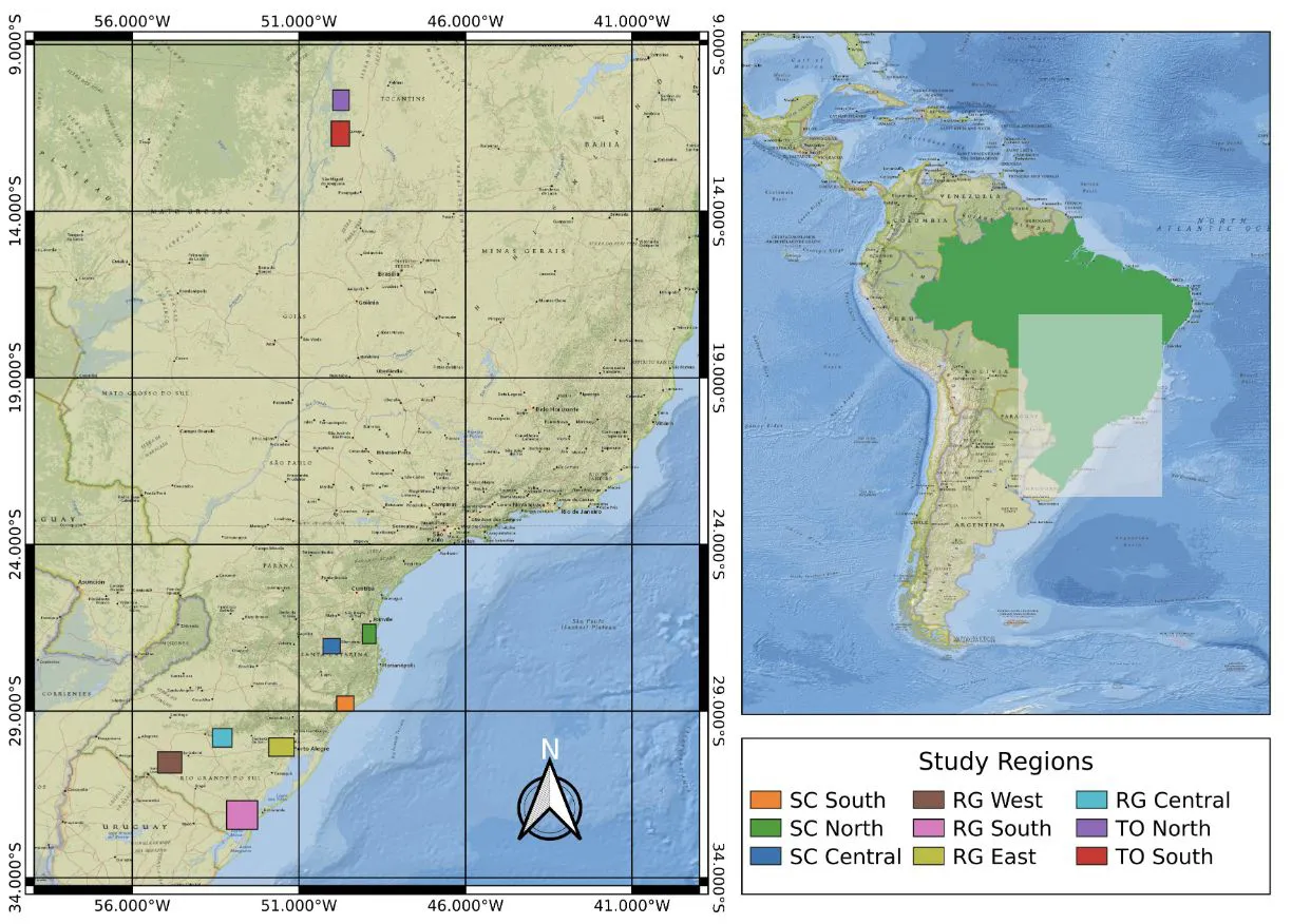
The study area: nine regions across southern and central Brazil.
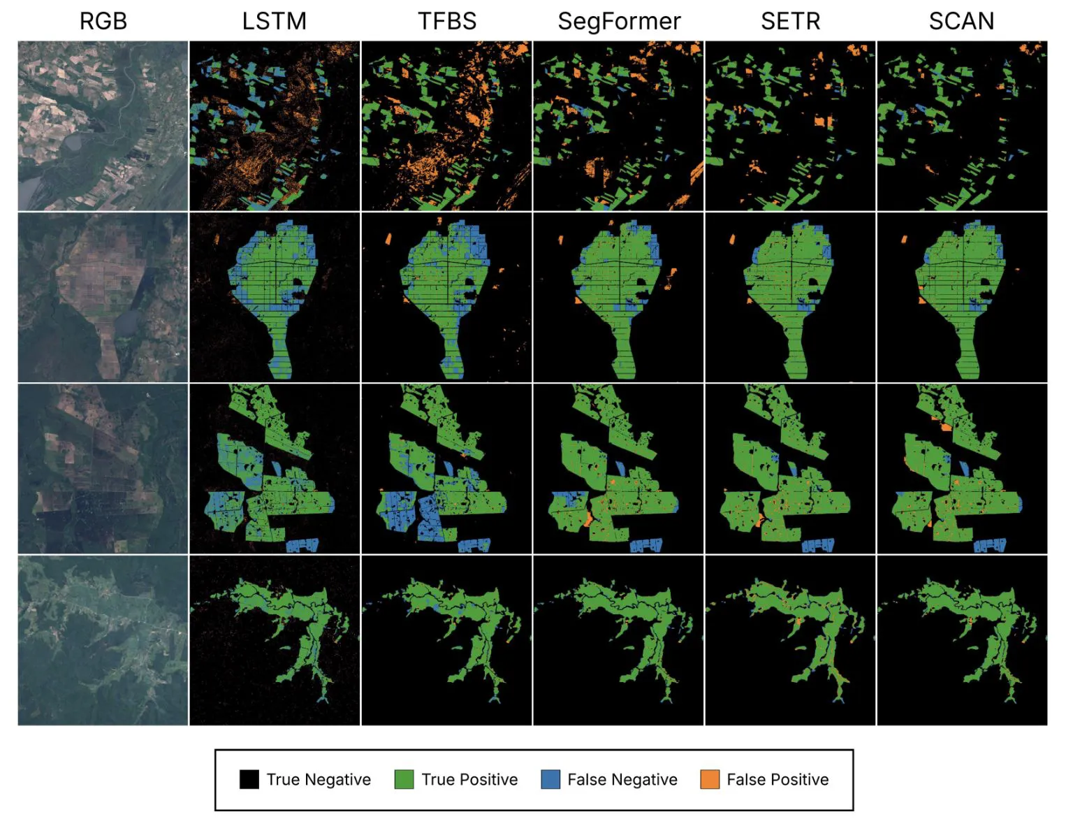
Qualitative comparison: our approach (SCAN) against LSTM, TFBS, SegFormer and SETR.