

On Wednesday, August 19, 2026, the ROSS Club held its first event as a hybrid session, in person in UCOMM 4-140 and online on Zoom. Dr. Alvin (Xinyao) Sun opened with a 15-minute introduction to MRC, ROSS and the Club, then Joshua Billson (PhD Student, MRC) gave the featured talk, Remote Sensing in Agriculture, followed by a lively Q&A. The recording, the key points and the discussion threads are below. The original announcement is here.
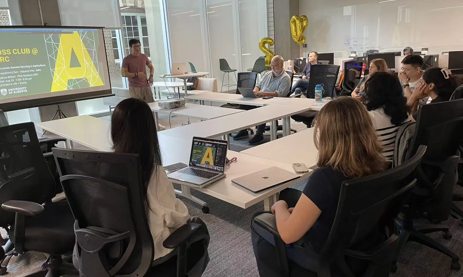
Dr. Alvin Sun opens the first ROSS Club event in UCOMM 4-140. Photo by the ROSS group.
Watch the recording
Watch on Zoom (about 90 minutes).
Part 1: MRC, ROSS and the ROSS Club
Alvin traced the pathway from MRC’s first remote sensing project in 2017 to the establishment of ROSS in 2026, the six challenges that recur in every real-world AI deployment, the wider pathway for students (CMPUT 617, the MM program, co-op and thesis work) and why the Club exists: partners bring more real problems than one team can pursue. The full story is written up in Introducing ROSS.
Part 2: Remote Sensing in Agriculture
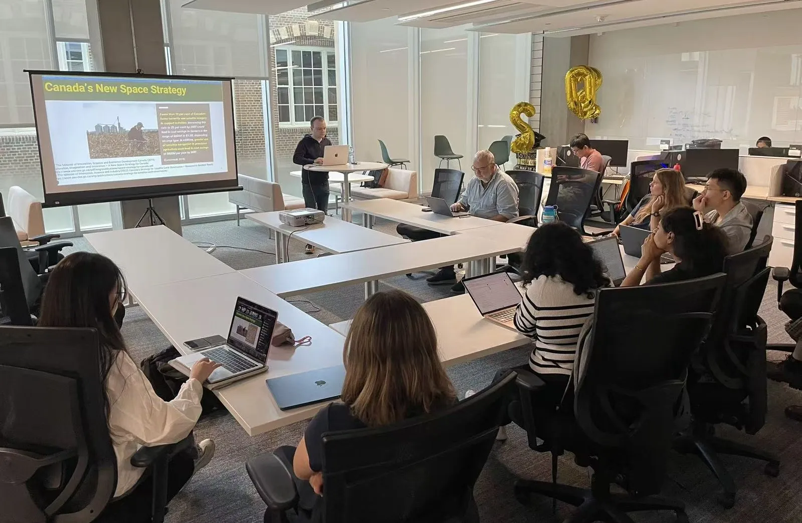
Joshua Billson opens the featured talk for the room and the Zoom audience. Photo by the ROSS group.
Why it matters. Canada’s space strategy notes that fewer than 10 per cent of Canadian farms use satellite imagery today, and that raising this to 25 per cent by 2027 could save farmers in the range of $650M to $1.3B a year depending on crop type, with a further $800M a year from satellite navigation in precision agriculture (Euroconsult figures cited in the strategy).
Fundamentals.
- Remote sensing measures reflected or emitted energy without touching the surface. Every sensor trades off spatial, temporal and spectral resolution: gaining one costs the other two.
- Surfaces have spectral signatures. Healthy vegetation absorbs visible light and reflects strongly beyond the red edge in the near-infrared, so indices such as NDVI compare the two ranges to read plant health. Stress flattens the curve.
- Multispectral sensors are sharp, clean and affordable but spectrally coarse. Hyperspectral sensors sample a continuum at the cost of resolution, noise and price.
- SAR works at night and through cloud, which matters because roughly two-thirds of the Earth’s land is under cloud at any moment, but it carries no spectral information. Its VV and VH channels separate rough-surface and double-bounce returns from the volumetric scattering of canopies, which depolarizes the signal.
- Phenology: each crop’s life cycle leaves a distinct trace in both backscatter and reflectance, which is what makes crops identifiable from orbit.
Applications. Crop mapping for policy and food-supply modelling (agriculture uses about 70 per cent of fresh water, 43 per cent of that for rice, and produces about 40 per cent of methane emissions), disease detection from spectral analysis, plant-health monitoring with frequent revisits, yield forecasting that combines deep learning, phenological models and in-situ data, and soil-quality mapping at scale.
Future directions.
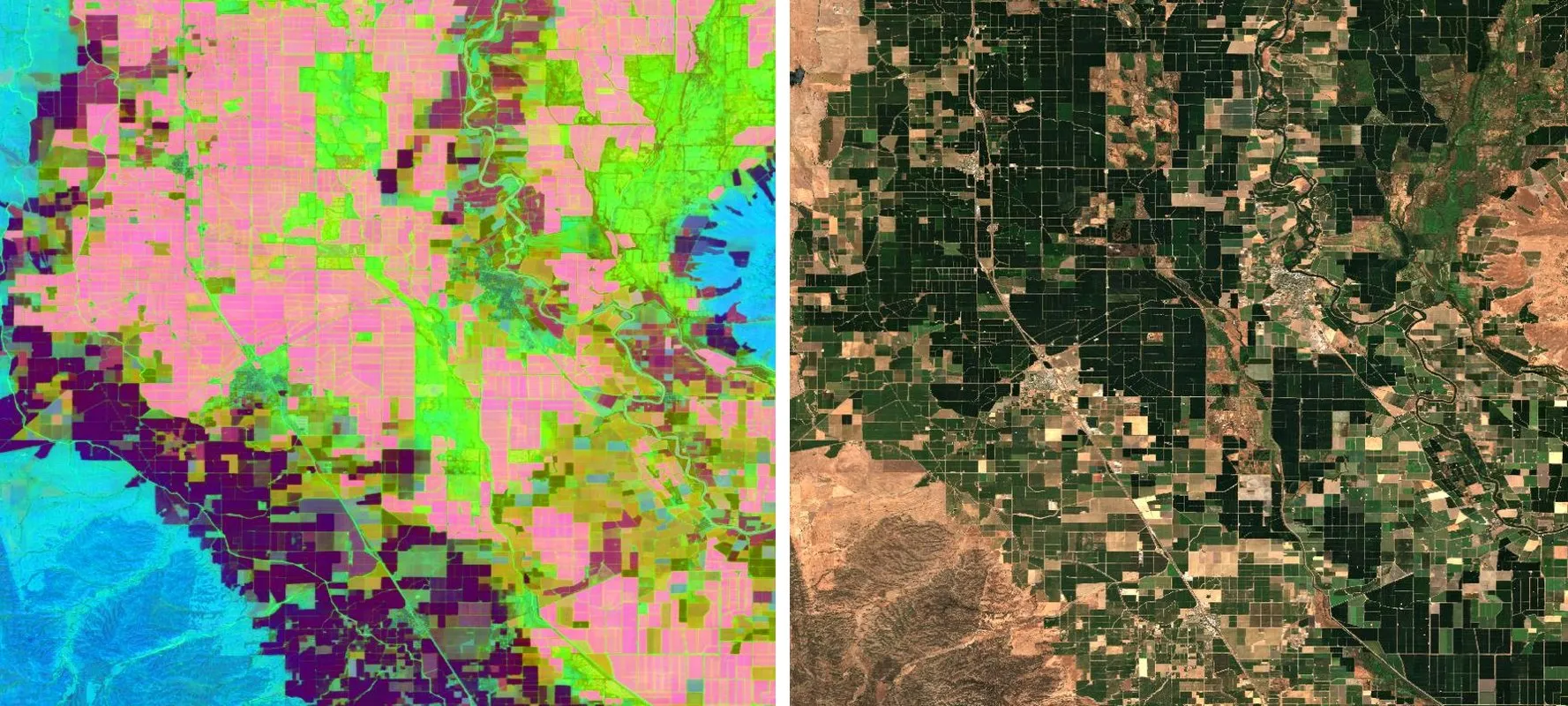
Sacramento Valley in RGB (left) and as a PCA visualization of AlphaEarth embeddings (right). Figure by Joshua Billson.
- Foundation models pre-trained on millions of images give general-purpose embeddings: open-weight Prithvi, Galileo and TESSERA, closed-weight AlphaEarth.
- Multimodality combines satellite time series (large-scale, temporally dense) with ground-level imagery (leaves, flowers, stems) and text that encodes geographic and domain knowledge.
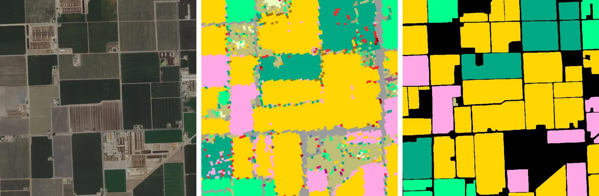
The same area in RGB, mapped pixel by pixel, and mapped field by field. Figure by Joshua Billson.
- Field-centric reasoning treats a field, not a pixel, as the unit of decision, which removes the speckle of pixel-wise maps.
- Large language models bring world knowledge, in-context learning and multi-step reasoning, with external knowledge passed in for domain performance.
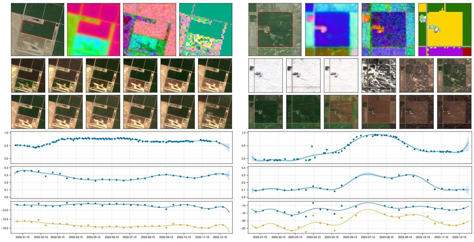
Phenological signals for corn (left) and almonds (right): RGB, AlphaEarth, Sentinel-1 series and CDL label, monthly Sentinel-2 mosaics, NDVI, the Sentinel-1 VH/VV cross ratio, and VV and VH backscatter. Figure by Joshua Billson.
- Reading the signals like an analyst. For corn, NDVI falls at senescence in late August while SAR backscatter holds until the combine harvests in October, so the gap between the two drops is itself a crop signature. For an almond orchard the pattern inverts: VH backscatter is high on bare branches and drops as the leaf canopy closes, then rises again as leaves dry in August. Joshua’s goal is an AI that reads these signals the way a human does and combines them with world knowledge to decide.
Discussion highlights
- What happens to radar inside a canopy? Professor Ioanis (Yannis) Nikolaidis, drawing on radio-frequency experience, offered another reading of the almond curve: a summer canopy adds many more scatterers, so paths lengthen and less energy returns, which would also explain why the drop is moderate rather than sharp. Joshua added two candidates, reduced penetration and absorption by wetter leaves, and described grounding the signals with dated street-level imagery. The physics behind the curve is an open question.
- Can an audio or music foundation model transfer to these time series? Not well: audio is sampled regularly and densely, while satellite series are irregular (cloud gaps, and even Sentinel-1 skips acquisitions during power-saving passes, more often over the Americas than Europe). A general time-series or market-forecasting model is a closer starting point.
- Do world models help multimodal fusion and forecasting? A world model, a latent state of the physical world plus its rules, is what lets a system extrapolate to unseen situations, the way a driver slows for a stopped bus even without seeing a pedestrian. Whether today’s language models build one, or only imitate reasoning, is still open. One test proposed in the room: reconstruct one modality’s time series from another (for example RGB from SAR). The fidelity of that reconstruction measures what the second modality really adds, and it is also a probe for a shared latent representation.
To follow the next events, join the ROSS Club newsletter or visit the Club page. Speakers, datasets and partnership proposals are welcome.
Further reading: A New Space Strategy for Canada (2019) · Canada’s Strategy for Satellite Earth Observation (2022)