
Tessera is a smart remote-observation platform that connects spaceborne, airborne, drone and ground sensing with AI, fusion and decision-grade Earth intelligence. It was built in the Multimedia Research Centre (MRC) by Shuping Tan (MSc with Specialization in Multimedia, 2025), and is co-developed by the joint R&D team of MRC / University of Alberta and Matrix Labs. The idea behind it is simple: from every observation, one decision.
Remote sensing without the workflow tax
Today, asking “how is my pasture this week?” is hours of plumbing. Hand-rolled in Google Earth Engine or a Sentinel Hub notebook, a single answer means writing a script to fetch the Sentinel-2 collection, masking clouds and bad pixels by hand, coding the biomass regression and vegetation indices yourself, exporting a GeoTIFF, and generating tiles, with no reproducibility metadata and a zipped folder to share. That is two to four hours to a first map.
Tessera turns the same task into minutes. Open the app, pick an algorithm card, and draw an area of interest on the map (or clip a pre-baked region). Cloud masking, the model and the tile pyramid all run automatically, and out comes a GeoTIFF, map tiles, a summary and an analysis report. Every run carries a run-id for reproducibility and a BibTeX citation, so a result is auditable and re-runnable. A pre-baked region returns in under a second; a fresh custom run takes five to seven minutes.
Pasture Health: the flagship
The first end-to-end vertical answers the rancher’s question, which paddock to graze this week. Sentinel-2 imagery flows through a biomass regression to a fully tiled biomass map in kilograms per hectare, alongside seven diagnostic vegetation indices (NDVI, EVI2, CIre, SAVI, WDRVI, NDSI and CI_green) and a six-class vegetation-clusters overlay. All ten layers sit in one switcher with independent visibility and opacity, so the biomass model output (how much forage is in the field) can be stacked against the true-colour view (what the field looks like from space). The cover image shows a sample run over Olds, Alberta.
How a run actually flows
A React and MapLibre front end on Firebase Hosting lets the user draw an AOI and submit. A FastAPI backend on Cloud Run mints the run-id and publishes the job, Cloud Workflows orchestrates four stages (fetch, biomass, cluster, tile), and the tiles and run record land in cloud storage for the results page to poll. The whole platform is built on open data and managed cloud services.
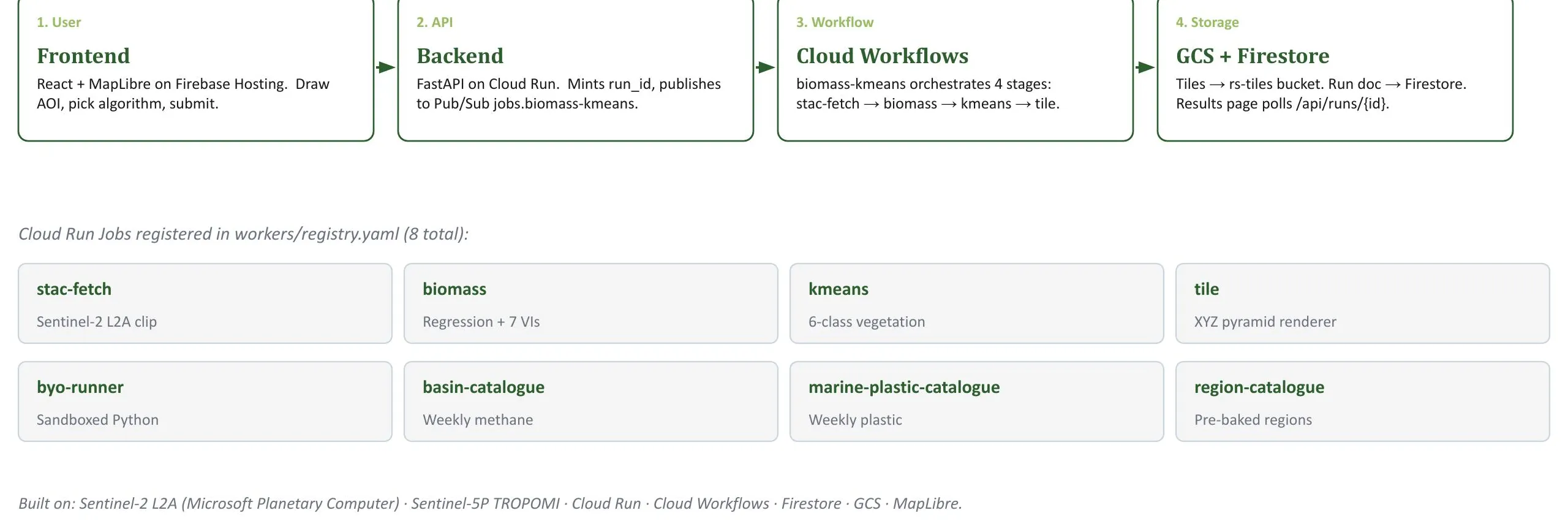 How a Pasture Health run flows, from the user’s click to a tiled result in five to seven minutes. Built on Sentinel-2 L2A (Microsoft Planetary Computer), Sentinel-5P TROPOMI, Cloud Run, Cloud Workflows, Firestore, GCS and MapLibre. Screenshot: Tessera (MRC).
One platform, many questions
Each tool runs on the same multimodal data fabric, fused to a unified 20 m grid. Three verticals are live or in beta today, each for a specific operator.
Methane plume detection triages super-emitter basins for regulators and climate researchers. It surfaces regional Sentinel-5P TROPOMI XCH4 enhancement maps with Bayesian plume clustering, working over a buffered window because the sensor is regional by design (5.5 by 7 km pixels).
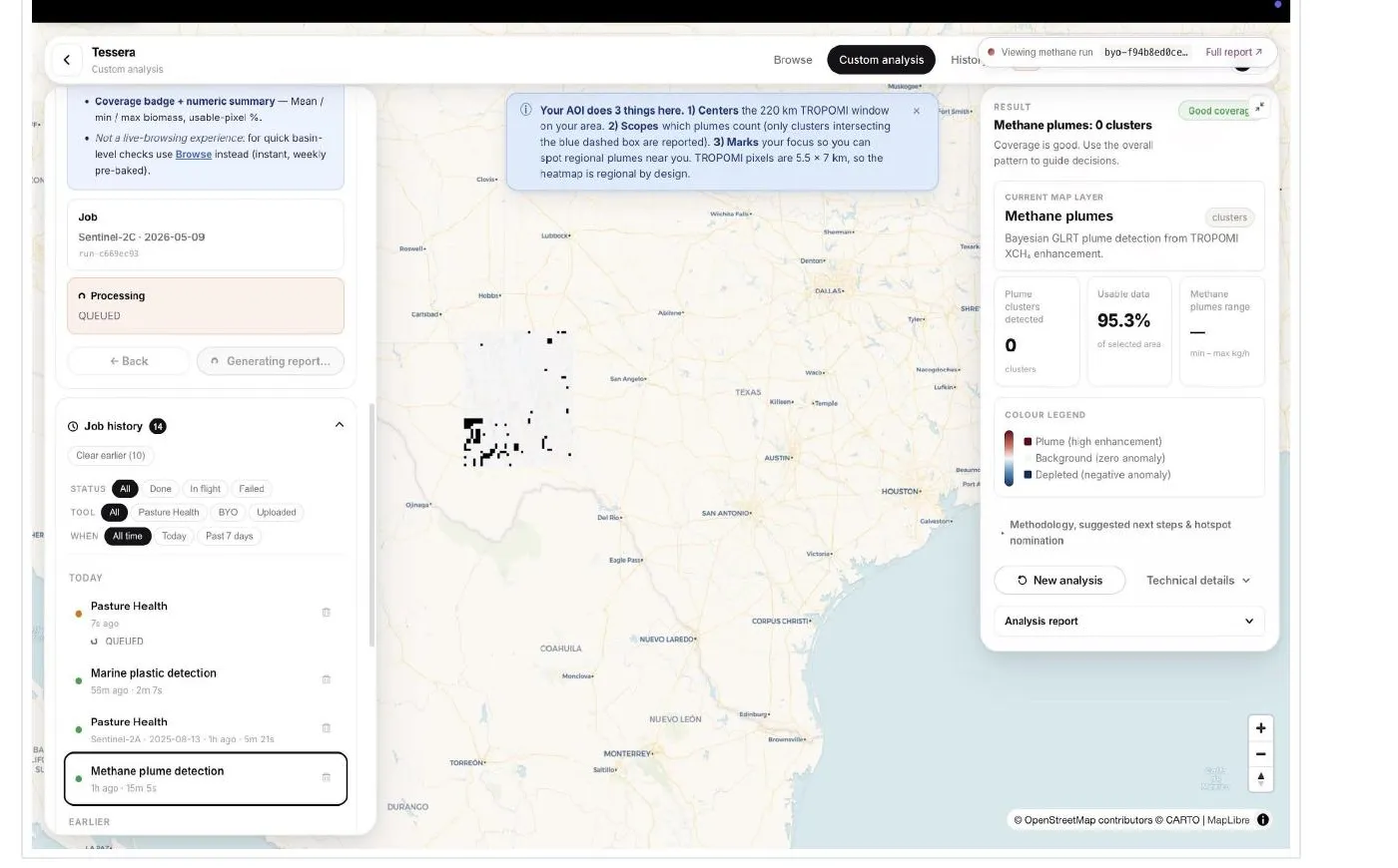 Methane plume detection: regional TROPOMI XCH4 anomaly with Bayesian plume clustering, for triaging basins between flyovers. Screenshot: Tessera (MRC).
Marine plastic detection spots candidate floating-plastic patches in coastal water from Sentinel-2 multispectral imagery, using the Floating Debris Index (Biermann 2020). Each patch is scored, sized in square metres and located.
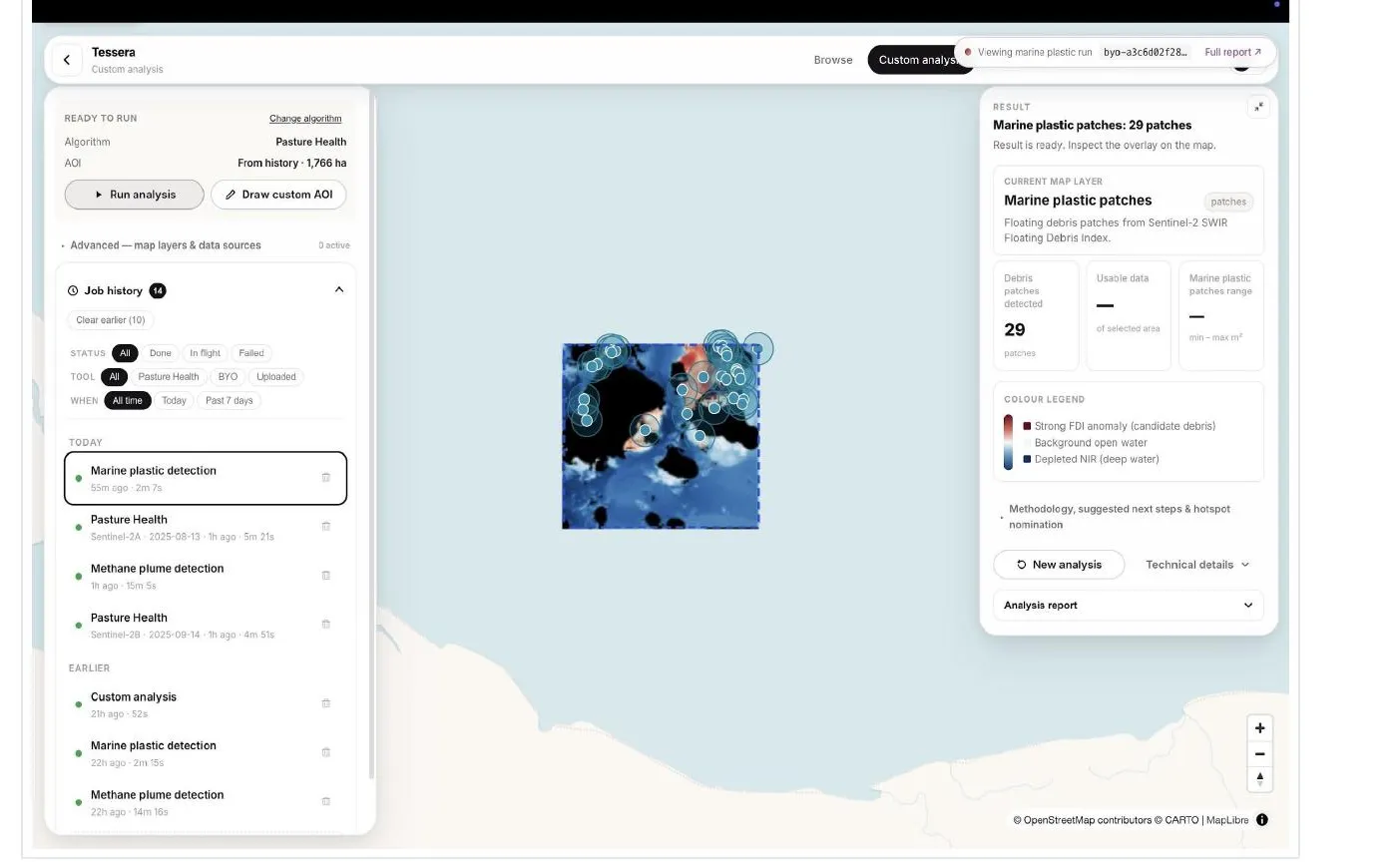 Marine plastic detection: Sentinel-2 Floating Debris Index patches, each scored, sized and located, for coastal-water researchers. Screenshot: Tessera (MRC).
For everyone else, BYO Python opens the same Sentinel-2 fetch and tile infrastructure to a power user’s own script. Crop stress, wildfire recovery, soil moisture and mine reclamation are scoped roadmap items.
From cloud to orbit
Today Tessera runs as a cloud platform: define an area of interest, combine spaceborne, airborne, drone, ground and public sources, and run joint R&D analysis workflows. The roadmap extends toward hybrid edge and orbit processing, where intelligent processing monitors sensor streams, fuses the high-value signals and routes structured outputs back to the cloud. In every case the output is the same, maps, detections and reports that support oil and gas, agriculture, infrastructure, environmental monitoring, research, education and public outreach, delivered as repeatable, citable decision workflows.
Explore the platform: Tessera Pasture Health, live app.