

Our remote-sensing research starts here. In 2017 the group began wide-area ground monitoring from space with InSAR, working with 3vG in Vancouver. What began as research has grown, over almost ten years, into satellite radar monitoring running in real deployments. This founding work brought the team its first Alberta funding, from the Consortium for Aerospace Research and Innovation in Canada (CARIC). That CARIC and Mitacs award, worth $1.4 million over 18 months across two universities and two companies, was the first CARIC funding in Alberta. It was followed by sustained NSERC support: a Department of National Defence supplement and a Collaborative Research and Development grant.
The scale is the challenge: a full-resolution InSAR footprint reaches roughly 30,000 × 20,000 pixels, about 600 million pixels per scene, and the algorithms must be robust, automatable and time-efficient. Over the years the collaboration built industry-grade workflows: large-scale InSAR pipelines, validation practices and partner access, delivering to clients ground movement plus a trust score for every spot.
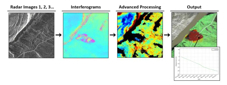
The InSAR pipeline: radar images → interferograms → advanced processing → output.
Under the hood, ground-movement signals are extracted with a two-step search (IGS-CMAES, broad then fine-tune) that works directly on circular, wrapped phase to avoid slow unwrapping. In parallel, ConvArcFit builds full-area motion maps from spatial and temporal neighbors, running in mini-batches over hundreds of millions of pixels. A complementary end-to-end DCNN tackles phase unwrapping with a periodicity-aware multi-frequency pixel embedding and a learnable Poisson conjugate-gradient solver, with denoising built in.
Proven in the field, the workflows are deployed with industry partners in Vancouver and beyond, across four infrastructure classes: roadways, railways, dams and mining.
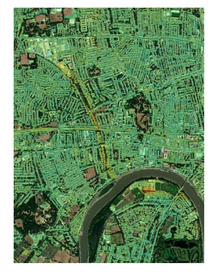
Roadways: city-wide InSAR overlay from a partner deployment with 3vG.